
What a gorgeous mid to late November stretch we've just enjoyed, with dry weather and above average temperatures. 60s and sunshine have been the common theme of the last week. We've also been precipitation free for the last 9 days and we'll squeeze out one more mainly dry day, but once the sun goes down, the risk of rain will increase Sunday.
The WBZ Weather Team has issued a NEXT Weather Alert for a round of heavy rain Sunday night. A developing area of low pressure off the southeast coast of the US will continue to gather moisture and become better organized Saturday night into Sunday. It will move up the East Coast, increasing clouds overnight and bring a quick burst of rain, with localized downpours and even some embedded thunderstorms Sunday night into early Monday morning.
Clouds will thicken and lower Sunday afternoon, with a few spotty showers developing by the early evening. Steadier rain will develop on Sunday night.
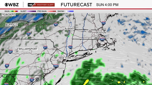
The heaviest rain will fall overnight Sunday through the predawn hours on Monday.
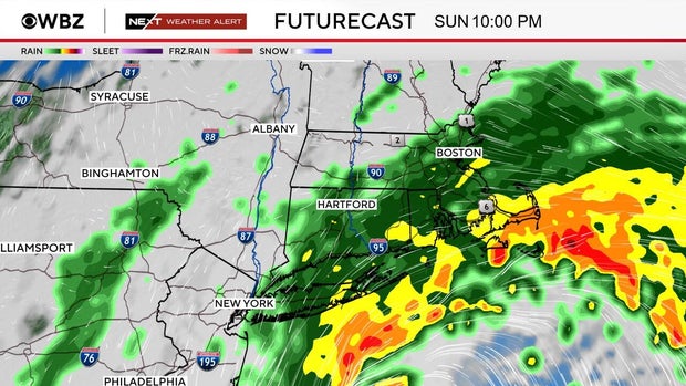
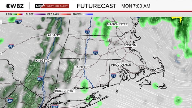
The storm will exit the coastline by dawn Monday, with just a few lagging showers at the coast mid-morning. By the afternoon, clouds will be decreasing as the storm lifts to the north and east and drier & cooler weather moves in.
There is potential for 1-3" of rainfall across the area, higher amounts where thunderstorms develop.
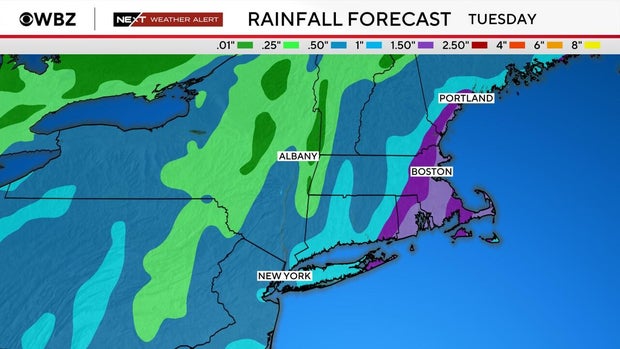
The highest risk for several inches of rain is across eastern and southeastern MA. Depending on the exact track of this area of low pressure, areas north and west of the heaviest rainfall may taper quickly in amounts.
There is no concern about large river or widespread flooding with this event. However, there may be some localized street/urban flooding underneath some of the heavier rain bands, especially where leaf litter/debris could be clogging the drains creating nuisance street flooding & low-lying area ponding.
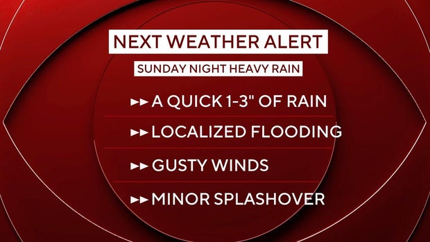
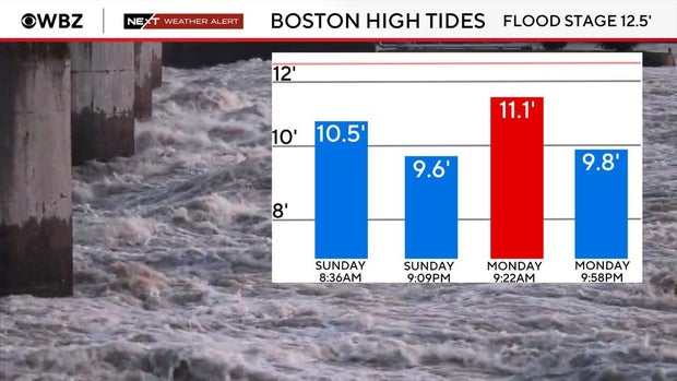
This storm will not bring significant coastal impacts, however as this area of low pressure passes, a few SE gusts 25-45 mph are possible at our coastline Sunday night. As for coastal flooding, right now it looks like any splash over or very minor coastal flooding is possible Monday morning near and during the time of high tide.
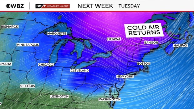
A reinforcing shot of cold air will follow this storm system as winds turn out of the west by late Monday... this will allow for a return to much cooler weather. In fact, temperatures will fall below seasonal normals, struggling to get out of the 40s. Overnight lows will also tumble, especially Wednesday morning as many areas will wake up to subfreezing temperatures.
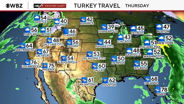
While we dry out early Monday, travel conditions look good for Tuesday and Wednesday. If you are flying, you'll want to check in with your airlines as there will be another storm system on our radar to move in on Thanksgiving. Once again, this system looks to arrive later in the day, with a cold rain, perhaps even a brief changeover or mix across the higher terrain and into parts of central and northern New England. Rain chances will continue on Friday before the system departs.
As always, stay with the WBZ Next Weather Team as we continue to monitor new information and update the forecast when needed!


